


 The Government Circuit: Driving Resiliency and Economic Security on Both Sides of the Atlantic
 American Made Advocacy: Taking the Fight to Capitol Hill
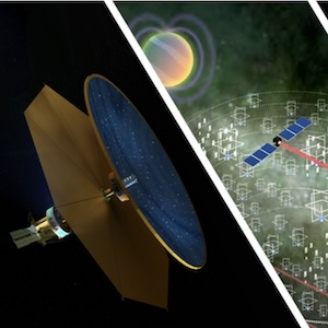
 Defense Speak Interpreted: SWaPing Nanosatellites for Defense Systems
Kongsberg Geospatial Integrates the World’s Highest Resolution 3D Terrain Data
September 14, 2020 | PRWEBEstimated reading time: 1 minute

Kongsberg Geospatial, developer of the TerraLens Geospatial SDK, and Vricon, a Maxar Company and geospatial intelligence data provider based in McLean, VA, announce that they will be demonstrating the world’s highest globally available 3D terrain resolution in a UAS ground control station in an upcoming online seminar hosted by the Association for Unmanned Vehicle Systems International (AUVSI).
The webinar will address the issue of flight safety while operating drones in convoluted environments and urban airspaces by using a combination of high-resolution terrain data that accurately plots the altitude and position of obstacles like buildings and towers, and real-time LoS (line of sight) calculations. The two technologies can be useful tools for collision avoidance in situations where it is necessary to operate unmanned aircraft in near proximity to buildings, powerlines, radio towers, and other infrastructure.
The webinar will also demonstrate how real-time Line-of-Sight (LoS) calculations can be used to predict problem areas for signal propagation and to help ensure effective sensor coverage.
Operation of drones in urban environments lack the accurate presentation of a digital surface model (DSM) to enable the situational awareness to avoid buildings. “In addition to building avoidance, it can be dangerous to lose the data connection with a UAV in the middle of a mission” explains Paige Cutland, Vice President at Kongsberg Geospatial, and one of the presenters. “However, using high-resolution data from Vricon and real-time LoS calculations, you can discover problem areas along your mission route ahead of time and adjust your flight plan to prevent problems before they happen.”
The geospatial data for this demonstration and seminar is being provided by Vricon, a Maxar company. Jonas Dehlin from Vricon will describe how to obtain and set up the best available geospatial data for a given mission area and demonstrate the level of detail that can be obtained through the use of high-resolution 3D surface models.
The presentation will feature 3D maps populated with 3D surface model data, which provide an extremely high level of fidelity, and high-resolution 3D globe terrain data that is useful for Line of Sight calculations.
The online seminar will be hosted on September 16th, at 3:00pm EDT by AUVSI.
Share on:


Suggested Items
Industrial PC Market Size to Record $1.75 Billion Growth from 2023-2027
05/03/2024 | PRNewswireThe global industrial pc market size is estimated to grow by USD 1.75 billion from 2023 to 2027, according to Technavio. This growth is expected to occur at a Compound Annual Growth Rate (CAGR) of almost 6.29% during the forecast period.
Gartner Survey Finds 61% of Organizations Are Evolving Their D&A Operating Model Because of AI Technologies
05/01/2024 | Gartner, Inc.Sixty-one percent of organizations are forced to evolve or rethink their data and analytics (D&A) operating model because of the impact of disruptive artificial intelligence (AI) technologies, according to a new Gartner, Inc. survey.
Real Time with… IPC APEX EXPO 2024: Operational Excellence and Smart Factory Initiatives
04/30/2024 | Real Time with...IPC APEX EXPOOperational excellence and operational efficiency are defined in this interview with Koh Young General Manager Joel Scutchfield. He touches on automation, AI, and collaboration as solutions to resource limitations. Koh Young's data-driven approach uses AI for process adjustments, data analytics, and supply chain enhancements. The discussion underscores the shift toward smart factory initiatives and the future of manufacturing, with a focus on reshoring, nearshoring, and technology utilization.
IDTechEx Report on Quantum Technology: Nano-scale Physics for Massive Market Impact
04/30/2024 | PRNewswireThe quantum technology market leverages nano-scale physics to create revolutionary new devices for computing, sensing, and communications. Across the industry, quantum technology offers a paradigm shift in performance compared with incumbent solutions.
NASA’s Optical Comms Demo Transmits Data Over 140 Million Miles
04/30/2024 | NASA JPLNASA’s Deep Space Optical Communications experiment also interfaced with the Psyche spacecraft’s communication system for the first time, transmitting engineering data to Earth.